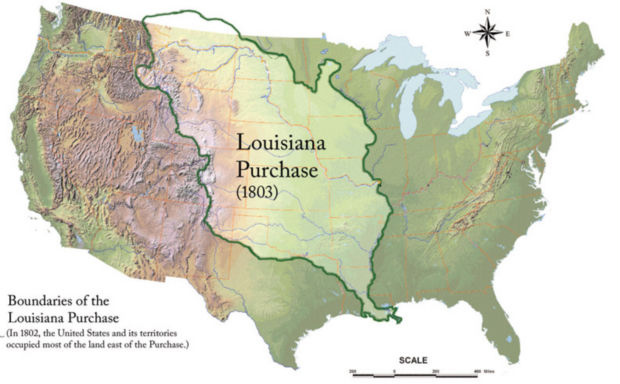
This map shows the boundaries of the Louisiana Purchase as recognized today. In 1802, the U.S. and its territories occupied most of the land to east.