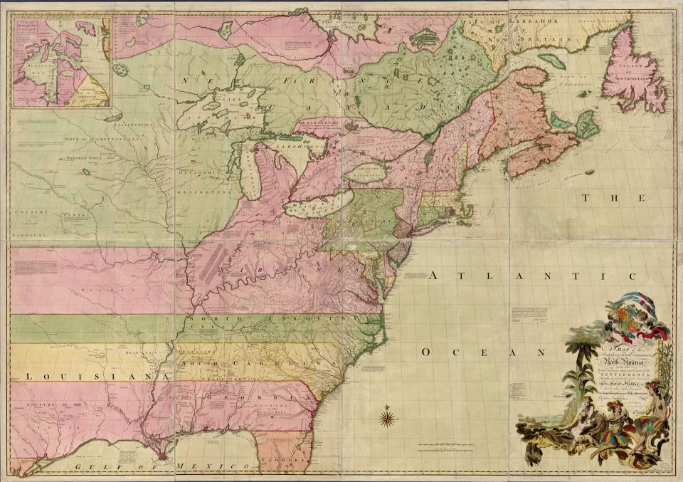
John Mitchell was born on Virginia, but he was living in England when he made this map in 1755. In his “Map of the British and French Dominions in North America,” Mitchell extended the boundaries of Virginia, the Carolinas, and Georgia westward to the Pacific Ocean, ignoring the claims of Britain’s Spanish, French, and Native American rivals.