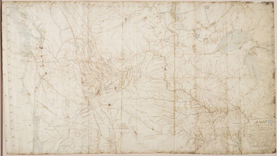
William Clark, who explored the West with Meriwether Lewis, made this map in 1810. The Great Lakes appear in the upper right corner; the Pacific Ocean is on the extreme left. Based on knowledge that Lewis and Clark acquired on their famous expedition, Clark’s map was used for decades, shaping how Americans thought about the geography of the West.