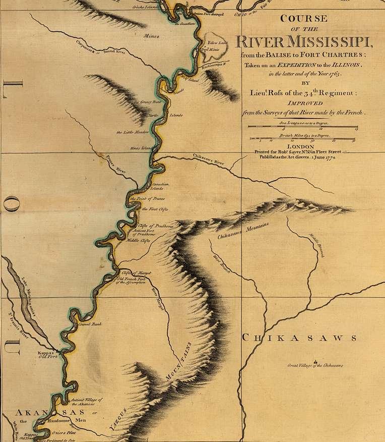
An English lieutenant made this map after 1763, when Great Britain acquired the Illinois territory as a result of winning the French and Indian War. Lieutenant Ross conducted the first official survey of the lower Mississippi River. As his map shows, the river passed through territory occupied by the Chicasaws and Indians.