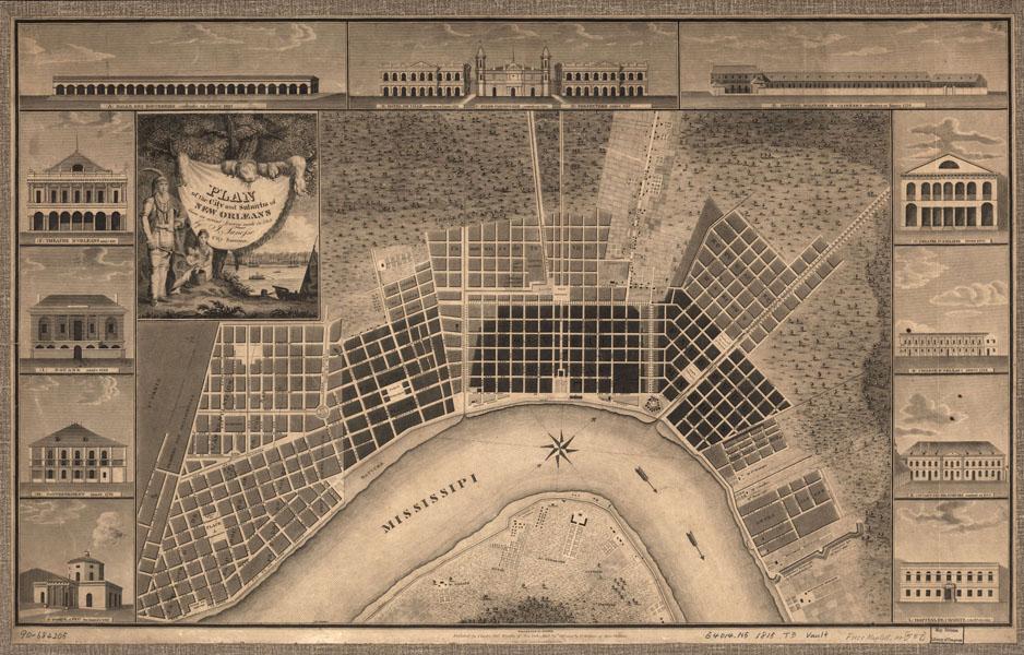
This map shows New Orleans in 1815. Most of the buildings pictured along the map’s borders were erected after the U.S. acquired the city in 1803. The decorative scene surrounding the map’s title represents two features of life in New Orleans and its region: thriving trade and the continued presence of Native Americans.