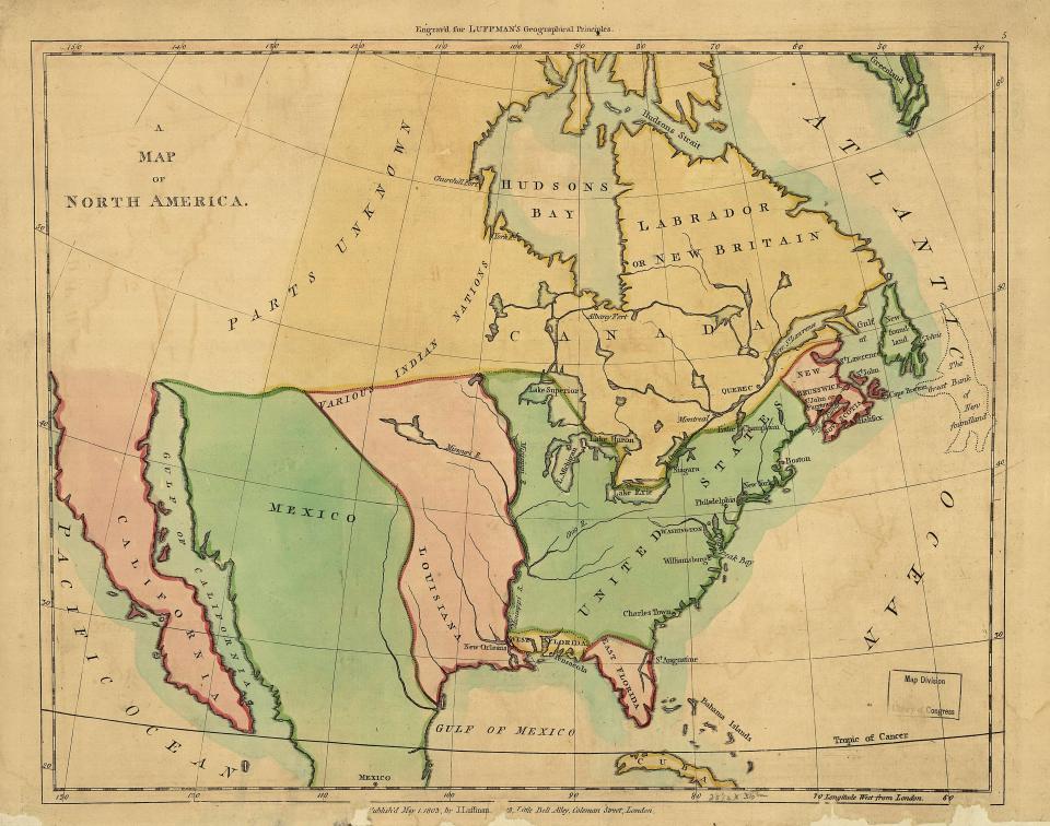
This map of North America was drawn not long before the Louisiana Purchase. The United States is shown here in green, with the Mississippi River as its western boundary. The mapmaker’s knowledge of geography beyond the river was sketchy at best. Note, too, that no Indian nations appear on the map, despite their continued presence on the continent.