
Topic: Native Americans

Lesson Plan
The Good, Bad, and Ugly: Comparisons and Contrasts of the Native American culture after the Lewis and Clark expedition
Students will compare and contrast Native American culture and demonstrate how it was affected by the land being obtained in the Louisiana Purchase by the American government.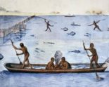

Media › image
Algonquian Fishing
This image is from among Englishman John White’s watercolor drawings of the Algonquian Indians. White was a thoughtful and respectful observer of Indian life near the Roanoke colony, settled in...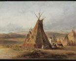
Media › image
Assiniboin Camp
This painting by the Swiss artist and explorer Karl Bodmer depicts an Assiniboin Indian settlement on the Great Plains in the 1830s. The Assiniboin are a Siouan people who were...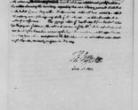
Media › document
Confidential Letter to Congress
In this letter to Congress, President Jefferson explained his plan to use trade as a weapon in his effort to put more white farmers on Indian land. Jefferson wanted to...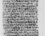
Media › document
Jefferson to William Henry Harrison
In this letter to the governor of the Indiana territory, President Jefferson explained how he would get the American Indians to give up their lands to white farmers. Jefferson’s plan...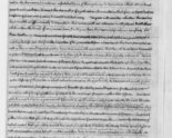
Media › document
Jefferson’s Third Annual Message to Congress
In this message to Congress, Jefferson argued that Louisiana was well worth its $15 million price. The vast territory included both the Mississippi River and the port of New Orleans....Lesson Plan
Jefferson’s Cipher to Lewis & Clark, Was It Necessary?
In this lesson, students will study the journals of Lewis and Clark and analyze the journals, specifically looking at information in the journal entries that describe hardships faced by Lewis...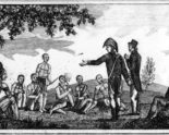
Media › image
Lewis and Clark
This etching shows Lewis and Clark meeting with some American Indians. It was one of several illustrations included in the journals of Patrick Gass, a member of the Lewis and...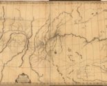
Media › image
Map of the Discoveries of Lewis and Clark
This map was the work of Robert Frazer, a member of the Lewis and Clark expedition. Frazer had kept a journal that he intended to publish. In 1807, after he...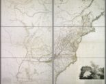
Media › image