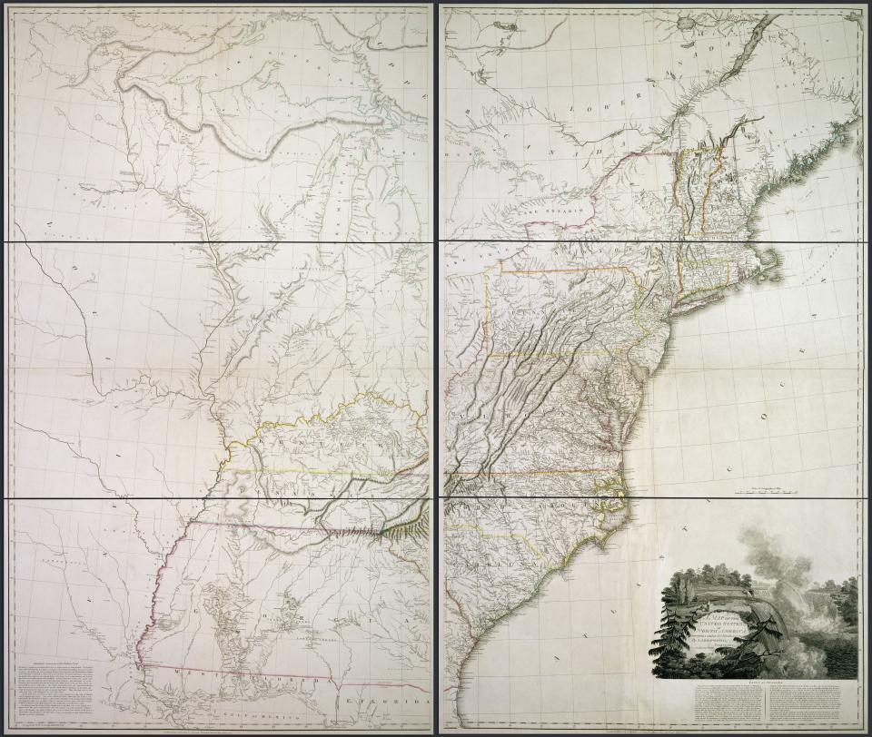
This map of the United States was made by an English mapmaker in 1796. Kentucky and Tennessee were the only western states and the state of Georgia still claimed the Mississippi River as its western border. Before the Louisiana Purchase, the Mississippi River was also the western boundary of the U.S. under the terms of the Treaty of Paris of 1783.