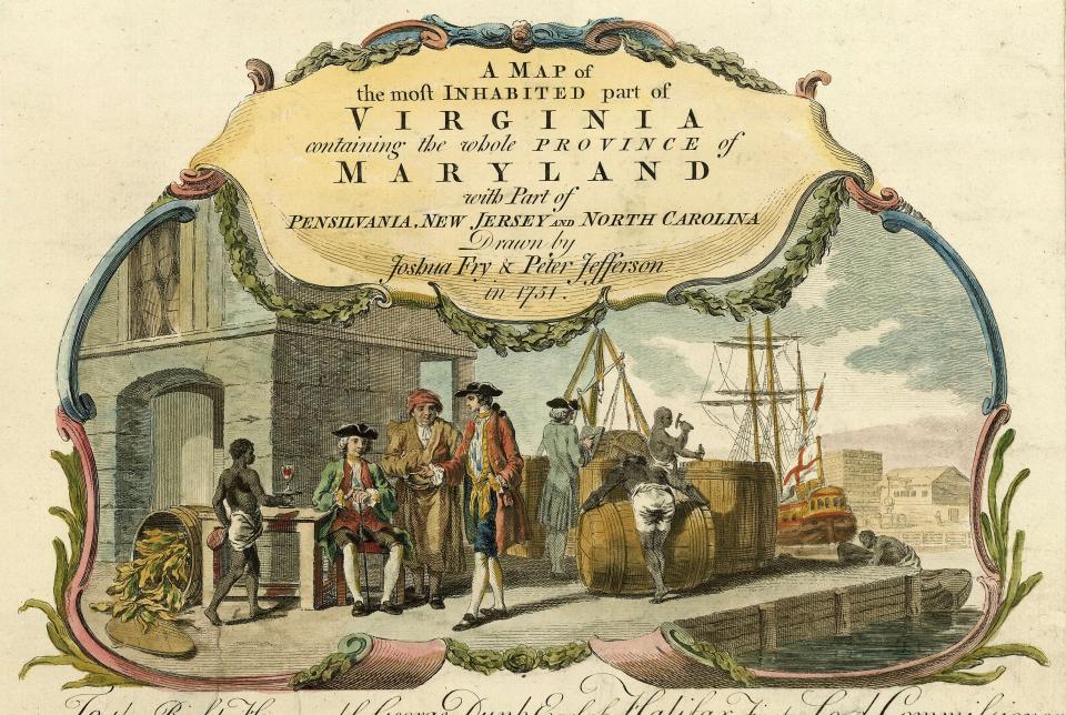
This cartouche, or shield-shaped design, is from a map produced by two Virginia surveyors, Colonel Joshua Fry and Peter Jefferson (father of Thomas Jefferson). By the mid-eighteenth century, British officials were taking a greater interest in colonial affairs. They requested a detailed map in order to gain a better understanding of the region’s products, geography, and population.