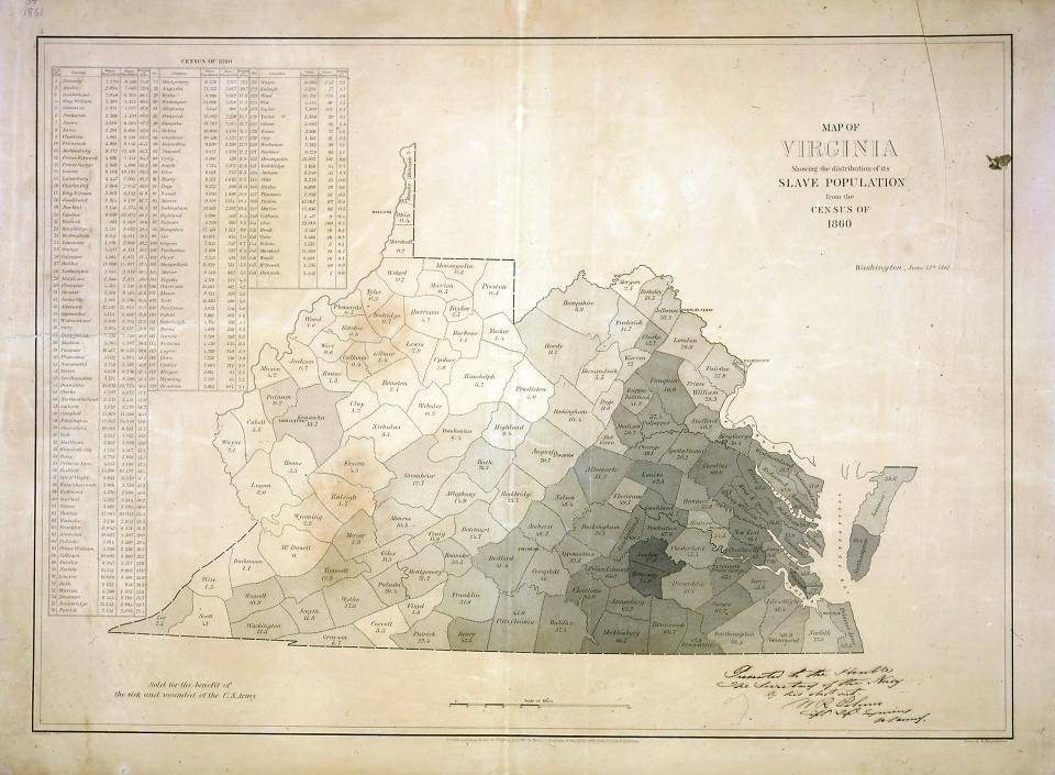
This map shows the distribution of Virginia’s slave population by county in 1860. The vast majority of enslaved people lived east of the Blue Ridge Mountains (in the darker-colored areas). Slavery was relatively uncommon in the western counties, forty of which became the separate state of West Virginia when Virginia seceded from the Union in 1861.