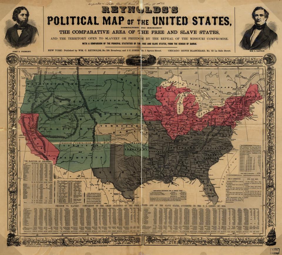
As this map indicates, the further expansion of slavery into the West was the central issue in American politics by 1856. The map’s publishers showed free states in pink and slave states in gray. These blocs competed for control of the territories–shown here in green–which would become states with votes in Congress and the Electoral College.